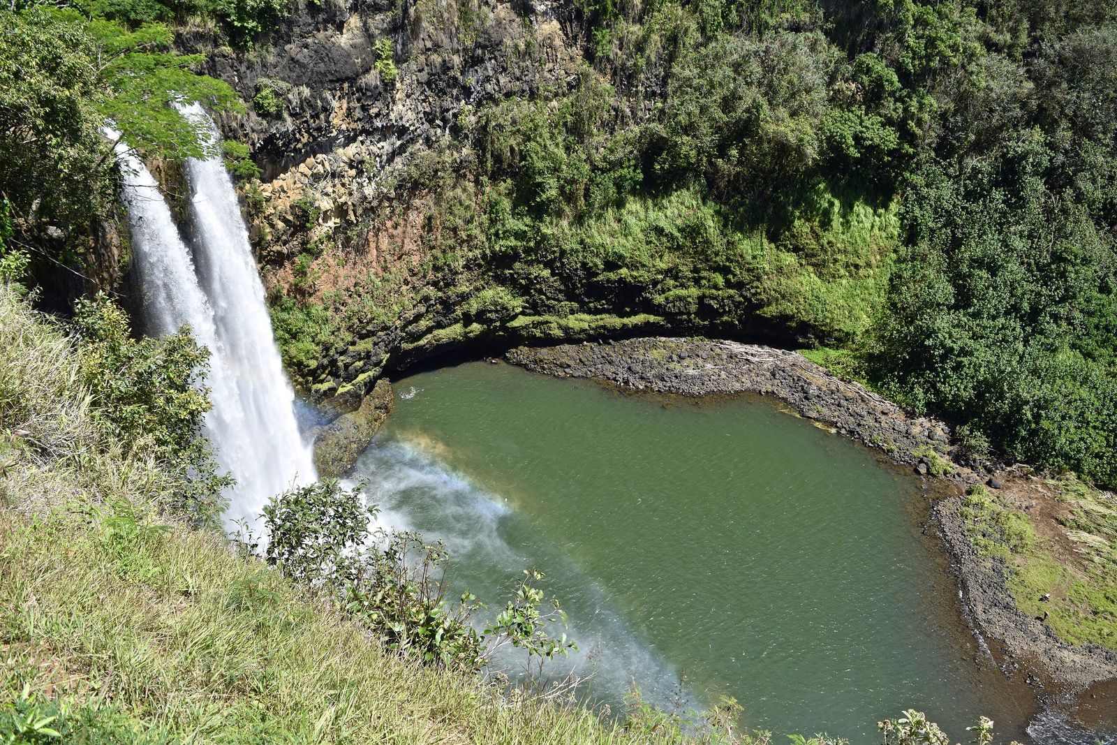
Big Island Hawai'i Jungle Guide
Most Big Island trips get planned around Kona — a resort strip on the dry, sunny side of the island where it almost never rains and the landscape looks like a black-lava moonscape with a golf course cut into it. That's a real place, but it's only half the island. Drive an hour or two east, over the saddle between two volcanoes, and the whole climate flips: the trade winds slam into the mountains, the rain stops being occasional, and the ground turns to genuine tropical rainforest, some of it barely a few decades old and still growing straight out of cooled lava. This is a working guide to that side of the Big Island — the Puna district's lava-heated jungle and the Hamakua Coast's waterfall country north of Hilo — covering how to get there, where to stay, what to actually do, and the honest caveats that don't make it into most vacation-brochure copy.
Why the Big Island turns to jungle here
The Big Island's climate splits along a line most first-time visitors don't know exists until they've driven across it. The island sits in the path of the northeast trade winds, which pick up moisture crossing thousands of miles of open Pacific and then slam straight into Mauna Kea and Mauna Loa, the two enormous shield volcanoes that make up most of the island's bulk. Forced upward, that moist air cools and dumps its rain on the windward, eastern side of the island — Hilo and everything north and south of it — while the western, leeward Kona side sits in the volcanoes' rain shadow and stays comparatively dry and sunny almost year-round. It's the same mechanism that makes Costa Rica's Caribbean and Pacific slopes feel like different countries, just compressed onto a much smaller island.
That windward side is what this guide covers, and it isn't one uniform stretch of jungle — it's two distinct regions with two different personalities. Puna, the island's easternmost district, is the youngest ground in Hawaii, built and rebuilt by Kilauea's lava flows within living memory, where dense lowland rainforest grows straight out of rock that's still warm in places. The Hamakua Coast, north of Hilo, is older, gentler country — former sugar plantation land now reverting to forest, cut by deep stream gulches and waterfalls, with none of Puna's volcanic edge but all of its rainfall. Both sides get soaked by the same trade winds; they just look and feel almost nothing alike once you're standing in them.
Hilo itself, the town that anchors both regions, is regularly cited as the rainiest city of its size in the United States — somewhere in the neighborhood of 130 inches of rain a year depending on which gauge and which averaging period you trust, spread across the better part of 300 days rather than concentrated into a short wet season. That statistic tends to scare visitors away from this side of the island, which is a mistake. It's exactly what keeps the ʻōhiʻa forest, the tree ferns, the waterfalls and the bright red rainforest flowers running at full volume nearly every day of the year, in a way the dry Kona coast never will.
Getting there
Two airports serve the Big Island, and which one you fly into changes your whole trip. Ellison Onizuka Kona International Airport (KOA), on the dry leeward coast, has the most direct mainland flights and the biggest selection of resort hotels nearby, but it puts Puna and Hamakua a genuine two-to-two-and-a-half-hour drive away, across the saddle road or around the island's southern tip. Hilo International Airport (ITO), on the windward side, has fewer direct mainland routes but drops you within twenty minutes of the Hamakua Coast and thirty to forty-five minutes of Puna — the better choice if the rainforest, not the beach resort, is the actual point of your trip.
A rental car is close to mandatory here. Hawaii County runs a free public bus system, the Hele-On Bus, but it's built around local commuting routes and schedules rather than sightseeing, and it won't get you to a trailhead or a waterfall lookout on your own timetable. The main roads themselves are in decent shape — Highway 19 runs the length of the Hamakua Coast toward Waimea and the Kohala side, Highway 11 connects Hilo to Hawaii Volcanoes National Park and on to Kona the long way around — but side roads narrow fast, and GPS in this part of the island is unreliable enough that a paper map or a downloaded offline map is worth having in the glovebox.
If you're combining a Kona beach stay with a Puna and Hamakua add-on, budget the crossing as a real travel day rather than a quick errand. The Saddle Road (Route 200) between Mauna Kea and Mauna Loa is the most direct route and has been substantially improved and widened in recent years, but it still climbs to roughly 6,600 feet, can be foggy or wet, and rental car agreements sometimes restrict its use — read the fine print before you plan on it.
Puna: lava-heated jungle and the Red Road
Puna is the district most people mean, whether they realize it or not, when they picture Big Island jungle. It's the island's easternmost corner, built almost entirely from Kilauea's lava over the past several hundred years, and parts of it are still being added to — the ground here is genuinely young by geological standards, some of it the youngest exposed land on Earth. Dense lowland rainforest, mostly ʻōhiʻa and fast-growing strawberry guava, has taken over the older flows, with pockets cleared for small farms, off-grid homesteads and the scattered subdivisions that make up much of Puna's population.
Highway 137, the Red Road
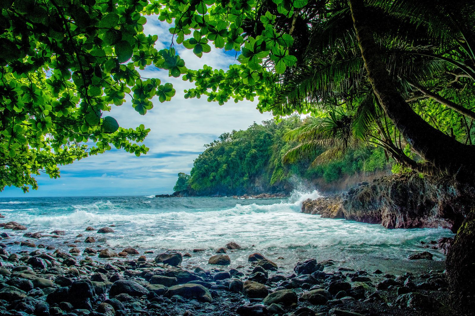
The signature drive through this landscape is Highway 137, universally known as the Red Road for the reddish cinder that once paved it. It runs along the coast south from the Kapoho area toward Kalapana, and in its intact stretches the jungle canopy closes almost completely overhead, turning the drive into a green tunnel broken by glimpses of black lava coastline. Along the way sit some of Puna's best-known stops: MacKenzie State Recreation Area, a windswept ironwood grove above sea cliffs; Kehena, a black sand beach reached by a short, steep trail down a cliff face, informally clothing-optional and popular with a mixed crowd of locals and visitors; and Isaac Hale Beach Park at Pohoiki, a boat ramp and surf spot that gained an unplanned black sand beach when the 2018 eruption pushed new land into the bay right beside it.
The 2018 eruption's mark on the map
No honest guide to Puna skips the 2018 lower Puna eruption, because it's still the single biggest fact about this landscape. Over several months that spring and summer, fissures opened in and around the Leilani Estates subdivision and eventually consolidated into one dominant vent, Fissure 8, which sent a lava flow north and east across a wide stretch of lower Puna and into the sea at Kapoho. It buried the Kapoho tide pools, the community of Vacationland and the volcanically heated Ahalanui warm pond entirely, added new coastline to the island, and closed a roughly four-mile stretch of Highway 137 between Kapoho and Pohoiki that remains under reconstruction years later — check current road status before you plan a drive that assumes the Red Road is fully open end to end. It's a sobering piece of context to carry with you here, not a reason to avoid the district: Puna's whole identity is built on the fact that this ground gets remade, and the jungle simply starts growing again the moment the lava cools enough to hold soil.
Pāhoa and Lava Tree State Monument
Pāhoa is Puna's unofficial capital, a small, unpolished wooden-storefront town that functions as the district's grocery run, gas stop and social hub, with a character that leans more homesteader than resort town. A few minutes outside it, Lava Tree State Monument protects a short, easy loop trail through forest where a much older lava flow, in 1790, swept through an ʻōhiʻa grove and left behind hollow stone molds of the tree trunks it engulfed — a strange, quiet reminder that Puna's relationship with lava didn't start in 2018 and won't end with it either.
The Hamakua Coast: waterfall country
North of Hilo, the coast road trades Puna's volcanic edge for something gentler and, in its own way, just as dramatic. The Hamakua Coast was sugar plantation country for more than a century, and since the last mills closed in the 1990s, the land has spent three decades reverting to forest — steep, stream-cut gulches thick with bamboo, guava and wild ginger, running down from the slopes of Mauna Kea to a rugged, mostly cliff-bound shoreline.
ʻAkaka Falls State Park
The single best payoff-to-effort stop on this coast is ʻAkaka Falls State Park, just outside the town of Honomū. A paved, roughly half-mile loop trail winds through bamboo groves, wild orchids and giant philodendron to a viewpoint of ʻAkaka Falls, a 442-foot single-drop waterfall, with the smaller Kahuna Falls visible from a second viewpoint along the same loop. It's an easy walk suitable for nearly anyone, and on a wet morning — which, on this coast, is most mornings — the bamboo grove alone is worth the stop.
Hawaii Tropical Botanical Garden
A few miles north of Hilo, above Onomea Bay near the town of Papaikou, the Hawaii Tropical Botanical Garden occupies a roughly 40-acre valley that was once a Hawaiian fishing village and later a sugar shipping point. It now holds more than 2,000 species of tropical plants across a curated but genuinely wild-feeling landscape, with a paved trail descending through the collection to a lookout over the bay itself. It's the easiest way on this whole coast to see rainforest plant diversity up close without a long hike, and it's a good rainy-day option since most of the trail sits under canopy.
Waipiʻo Valley
The Hamakua road ends, for practical purposes, at the Waipiʻo Valley Lookout outside Honokaʻa. Waipiʻo is the first and largest of a chain of amphitheater valleys cut into the windward flank of the Kohala Mountains, roughly a mile wide and over five miles deep, walled by cliffs that climb close to 2,000 feet, with a black sand beach at its mouth. It held real political and religious significance in old Hawaii, long considered the boyhood home of Kamehameha I, and the view from the lookout — jungle-walled, waterfall-streaked, opening onto the ocean — is one of the best on the island for the price of a short walk from the parking lot. The road down into the valley floor itself is exceptionally steep, unpaved in stretches and effectively 4WD-only, and access rules for hikers and vehicles have changed more than once in recent years; check current conditions before assuming you can simply walk down.
Puna and Hamakua are the same trade winds hitting two different kinds of ground — one still young enough to remember being lava, the other old enough to have grown a full plantation history and then let the jungle take it back.
Where to stay
Where to base yourself should follow which side of the rain you want to wake up in. Puna, particularly around Pāhoa and the coastal stretch near the Red Road, leans rustic and off-grid — properties built into lava-field jungle, plenty of them solar-powered, closer to the district's homesteader roots than to anything resort-branded. It's the right base if you want to be inside the jungle rather than driving to it each morning, and it's usually the most affordable stay on this side of the island.
Volcano Village, just outside the entrance to Hawaii Volcanoes National Park, sits at a cooler, mistier elevation inside genuine native ʻōhiʻa forest and has built a real niche around treehouse and jungle cabin stays — close enough to walk or drive a few minutes into the park, and a good middle-ground base if you want both rainforest and volcano access without committing fully to Puna's lower, warmer coast.
Hilo itself, and small Hamakua towns like Honomū near ʻAkaka Falls or Honokaʻa near Waipiʻo, offer a more conventional home base — closer to grocery stores, restaurants and gas stations, with easy access to both the waterfalls and the drive up toward the park. It's the least rustic option and the easiest for travelers who want jungle scenery by day and a normal town by night.
For a shortlist of vetted jungle-adjacent stays across the island, see our Hawaii destination page, or browse the wider directory if you're still weighing the Big Island against another jungle destination. And if you're the one thinking about listing a jungle property rather than booking one, our guide on how to start a jungle Airbnb is a useful next stop.
Good to know
Puna in particular has a real off-grid streak — solar power, catchment water systems and spotty cell coverage are common even at established stays. It's part of the district's character, not a flaw, but confirm water and power setup with your host before you arrive if that matters to your trip.
The best things to do
- Drive the intact stretches of the Red Road: Highway 137 through Puna, jungle closing overhead in places, with stops at MacKenzie State Recreation Area, Kehena black sand beach and Isaac Hale Beach Park at Pohoiki.
- Walk the loop trail at ʻAkaka Falls State Park: under a mile round-trip through bamboo and wild orchid, ending at a 442-foot waterfall — one of the best payoff-to-effort walks on the island.
- Spend a few unhurried hours at the Hawaii Tropical Botanical Garden: 2,000-plus tropical plant species in a working valley above Onomea Bay, most of it shaded and walkable in any weather.
- Look down into Waipiʻo Valley from the lookout: a mile-wide, jungle-walled valley with a black sand beach at its mouth and deep roots in Hawaiian history.
- Walk through Lava Tree State Monument: a short, easy loop past 1790-era lava molds of an ʻōhiʻa grove, a quiet counterpoint to the 2018 flows a few miles away.
- Spend a full day in Hawaii Volcanoes National Park: the crater rim area, steam vents, the ʻōhiʻa forest ringing Kilauea's summit, and the Thurston Lava Tube (Nāhuku) dropping straight from rainforest canopy into a centuries-old lava tunnel.
- Chase Hilo's town waterfalls: Rainbow Falls and Peʻepeʻe Falls sit inside Hilo itself, both viewable from short, paved, roadside walks — an easy add-on to any day based in town.
- Soak in a warm pond, where one is currently open: Puna's volcanically heated ponds have come and gone with eruptions over the decades — Ahalanui was buried in 2018 — so check current conditions locally rather than planning around an old trip report.
Day trips beyond Puna and Hamakua
Hilo itself deserves more than a drive-through. It's the region's real town — a working harbor city with a genuine downtown, a farmers market running several days a week, and a slower pace than anything on the Kona side. Rainbow Falls, on the edge of downtown, and the botanical garden a short drive north make it easy to fold an hour or two of sightseeing into an otherwise practical grocery-and-gas stop.
Hawaii Volcanoes National Park, established in 1916 and protecting the summits and slopes of both Kilauea and Mauna Loa, is the single best full-day add-on from either Puna or the Hamakua Coast — roughly forty-five minutes from Hilo, closer still from Volcano Village. The Kilauea side of the park is ringed by wet native ʻōhiʻa forest thick with birdlife, a striking contrast to the steaming, largely lifeless caldera at its center, and the short walk through the Thurston Lava Tube drops you straight from rainforest canopy into a tunnel carved by a lava river centuries ago — as good a one-stop summary of this whole side of the island as anywhere. Kilauea's activity is monitored continuously by the USGS Hawaiian Volcano Observatory, and access to parts of the park can open or close on short notice depending on conditions, so check current status before you build a day around it.
Laupāhoehoe Point, along the Hamakua coast road between Hilo and Honokaʻa, is a smaller stop worth the detour — a black lava peninsula jutting into the surf, with a memorial to the 1946 tsunami that struck the school that once stood there, and a reminder that this coast's beauty and its hazards have always come from the same ocean.
For travelers with more time, this side of the island pairs naturally with the drier Kona coast for contrast, or with an inter-island hop to see how differently the same trade-wind mechanics play out elsewhere — our broader look at why jungle stays are booming covers some of what's driving demand for exactly this kind of trip.
Food and practicalities
Hilo has the region's real food scene — a mix of long-running local plate-lunch counters, a well-regarded farmers market running several mornings a week near Kamehameha Avenue, and a growing handful of restaurants leaning into Hawaii regional cuisine and locally grown coffee and produce. Pāhoa, in Puna, is smaller and more casual, but it holds a genuine cross-section of the district's character in a few blocks of wooden storefronts, from simple diners to health-food-leaning cafés serving the area's homesteader and off-grid population.
Hawaii is one of the more expensive U.S. destinations to eat and shop in, since almost everything arrives by ship or plane, and that shows up on a grocery receipt or a dinner bill here as much as anywhere else in the state. A realistic budget traveler should plan on $100 to $160 a day for a simple rental car, basic lodging and mostly self-catered or plate-lunch meals; a comfortable mid-range trip runs $250 to $400 a day once a nicer rental property, restaurant meals and a few paid activities are factored in. Hawaii Volcanoes National Park charges a standard National Park Service per-vehicle entrance fee valid for seven days, or accepts the annual America the Beautiful pass — it's the only formal park entry fee anywhere in this guide, since the Hamakua waterfalls and Puna's coastal jungle involve no comparable ticketing beyond occasional small county park fees.
Cell signal and WiFi are reasonably reliable in Hilo and at most established lodges on both coasts, but coverage thins out fast in rural Puna and along stretches of the Hamakua coast road — the same practical habit worth carrying into any remote jungle destination, from the cloud forests of Peru to the coffee highlands of Colombia. Download offline maps and tell your accommodation your rough plans before a longer hike or drive down an unfamiliar road.
When to go
The Big Island doesn't run on the sharp wet-season, dry-season split you'd find in Southeast Asia or Central America. It has two broad seasons — a wetter, cooler "winter" roughly November through March, and a drier, warmer "summer" roughly April through October — but on Puna and the Hamakua Coast, rain is a near-constant backdrop rather than a season you can dodge or plan around escaping entirely.
- November–March: the wetter, cooler months, with more frequent storm systems and the highest odds of a multi-day soggy stretch. Waterfalls run fullest in this window, which is a real upside if that's what you're chasing.
- April–May: a shoulder period many repeat visitors like — rain eases from winter peaks, trade winds are steady, and crowds haven't hit summer levels yet.
- June–August: the driest, warmest stretch overall on this side of the island, though "dry" here still means regular showers — expect a pattern of sun, rain and sun again rather than a true dry spell. This is peak family travel season, so lodging and flights price accordingly.
- September–October: another comparatively quiet shoulder window, warm with thinning crowds, before winter's wetter pattern sets back in.
Volcanic activity doesn't follow a calendar at all, which matters more here than the weather does. Kilauea has had multiple eruptive episodes in recent years, both within the national park's summit caldera and, as in 2018, in populated lower Puna, and none of it follows a predictable season. Check the USGS Hawaiian Volcano Observatory's current updates before finalizing a trip, and again once you've arrived, rather than assuming last year's conditions still apply.
The honest caveats
This side of the Big Island earns its reputation, but it deserves a clear-eyed pitch rather than a glossy one. The rain is the first honest caveat, and it isn't a minor inconvenience — Hilo's rainfall totals are genuinely near the top of any list of wet places in the country, and a multi-day trip here without at least one washed-out plan is unusual. Pack for it, build slack into your itinerary, and treat a rainy morning as normal rather than a disappointment.
The 2018 eruption's legacy is the second. Parts of lower Puna, including a stretch of the Red Road itself and several of the district's best-known former landmarks, are gone or altered for good, and reconstruction of the road has taken years longer than initial estimates suggested. Drive the Red Road expecting a partial route rather than the full historic drive, and treat any online description of Ahalanui pond, the Kapoho tide pools or Green Lake as history rather than a current attraction.
Connectivity and services thin out fast once you leave Hilo or Pāhoa's main strips, which is a feature for travelers looking to disconnect and a real frustration for anyone planning to work remotely from a jungle cabin. And volcanic risk, while genuinely well-monitored and rarely disruptive to a typical visitor's plans, is not zero — this is one of the most geologically active places on Earth, and checking current conditions before and during a trip is a simple, necessary habit rather than an overreaction.
None of that should scare a serious traveler off. It's the same honest math that applies to any destination built around an active natural system, whether that's an active volcano in Costa Rica or a coastline that reshapes itself with every big storm — the intensity that makes the place worth visiting is the same intensity that demands you show up informed.
Common questions
How many days should I spend in Puna and Hamakua?
Three to four full days is a realistic minimum: one for the Red Road and Puna's lava-country stops, one for ʻAkaka Falls and the Hawaii Tropical Botanical Garden, one for Hawaii Volcanoes National Park, and a flexible day for Hilo town, Waipiʻo Valley or a rained-out plan from earlier in the trip.
Is it safe to visit Puna given the 2018 eruption?
Yes, for the great majority of the district. The 2018 flows covered a defined area of lower Puna that's now mapped and well understood, and the rest of the district, including Pāhoa and most of the Red Road, has been open and safe to visit for years. Kilauea's ongoing activity is closely monitored by the USGS Hawaiian Volcano Observatory, and it's worth checking current conditions before your trip rather than relying on outdated news coverage of the eruption itself.
Is the Red Road (Highway 137) fully open?
Not entirely. A stretch between Kapoho and Pohoiki has been closed since the 2018 eruption buried it, and reconstruction has taken longer than early estimates suggested. The rest of the route, including the stretch past MacKenzie State Recreation Area, Kehena and Isaac Hale Beach Park, is generally open — check current Hawaii County road status before you drive out expecting the full historic route.
Which is better for a first visit, Puna or the Hamakua Coast?
They're different enough that most travelers with more than two or three days should do both. Hamakua is the easier, more conventionally scenic introduction — waterfalls, a botanical garden, a dramatic valley lookout, all close to Hilo. Puna is rawer and more distinctive, with lava-field jungle, a real off-grid culture and the Red Road, but it rewards a bit more planning around what's currently open.
Do I need a 4WD vehicle?
Not for the main sights covered in this guide — Highway 137, Highway 19 and the drive to the Waipiʻo Valley Lookout are all doable in a standard rental car. The road down into Waipiʻo Valley itself is a different story: it's exceptionally steep and effectively 4WD-only, and most visitors see the valley floor by guided tour rather than driving down themselves.
What's the best time of year to visit for waterfalls?
Waterfalls on both the Hamakua Coast and in Puna run fullest during the wetter months, roughly November through March, when rainfall peaks. For a steadier balance of good flow and fewer washed-out days, April through May and September through October are solid shoulder-season picks.
Where to go from here
Puna and Hamakua reward travelers who accept the rain as part of the deal rather than fighting it, and who build in enough flexibility to swap a beach day for a museum or a botanical garden when the forecast calls for it. Start with our Hawaii destination page for a shortlist of vetted jungle-adjacent stays, or browse the full directory if you're still weighing the Big Island against another jungle destination entirely, from Puerto Rico to Florida. If active volcanic landscapes are part of the draw, our La Fortuna and Arenal Volcano guide covers a similar pairing of rainforest and live geology in Costa Rica, and our roundup of the best jungle Airbnbs in the world is a good next stop if you're still comparing regions before booking anything.
- Wikipedia — Hawaii Route 137 — Red Road history, landmarks along the route, and the 2018 eruption's closure of the Kapoho-to-Pohoiki segment.
- Hawaii County Recovery Site — Infrastructure — current status and reconstruction timeline for the closed section of Highway 137.
- National Park Service — Hawaiʻi Volcanoes National Park — park founding year, features, monitoring by the USGS Hawaiian Volcano Observatory, and entrance fee structure.
- Go Hawaiʻi — Waipiʻo Valley Lookout — valley dimensions, history and access conditions on the Hamakua Coast.
- Hawaii Tropical Botanical Garden — About — Onomea Bay valley history and garden size and plant collection.
- Love Big Island — ʻAkaka Falls — waterfall height, loop trail distance and Kahuna Falls viewpoint.
- Hoku Hawaii Tours — Rainiest City in the U.S.? Hilo! — Hilo's annual rainfall totals and rain-day frequency.
- USGS — Kīlauea — Hawaiian Volcano Observatory monitoring and background on the 2018 lower Puna eruption.
More from the Journal.
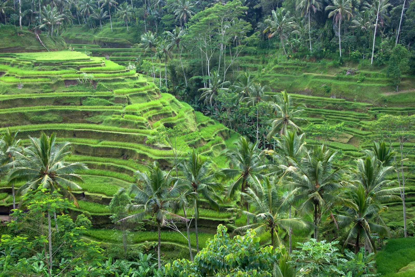 Photo: Vyacheslav Argenberg, CC BY 4.0
Ubud Jungle Guide
Bali's cultural heart is ringed by river gorges and terraced forest. Where to stay in the Ubud jungle, what to do, and how to escape the crowds.
 Photo: Adimelali Bali, CC BY-SA 3.0
Sidemen, Bali: The Quiet Valley Guide
An hour from Ubud and a decade behind it — Sidemen is the rice-terrace valley under Mount Agung where Bali's best bamboo houses hide.
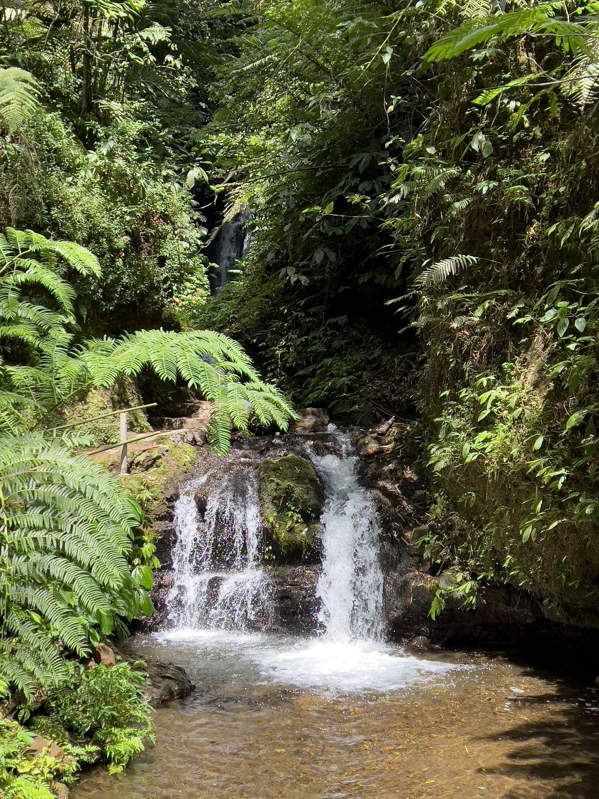 Photo: Stefan Fussan, CC BY-SA 3.0
Munduk & North Bali Highlands Guide
Bali's cool, waterfall-laced highlands — coffee country, twin lakes and jungle ridges two hours from the beach crowds.
 Photo: Derek Ramsey (Ram-Man), CC BY-SA 4.0
Find your own piece of the canopy.
Treehouses, bamboo houses and rainforest villas across 17 destinations — found, vetted and written up honestly.
Browse all destinations